Aerodrome Safeguarding
& Inspection Tool
Next-generation aeronautical obstacle analysis. ICAO Annex 14 and PANS-OPS evaluations in seconds — no installation, no login required.
Next-generation aeronautical obstacle analysis. ICAO Annex 14 and PANS-OPS evaluations in seconds — no installation, no login required.
ASIT is the aeronautical obstacle analysis platform developed in-house by Altitude Nexus. Built for aviation engineers, airports, ANSPs and wind farm operators, it automates complex ICAO surface calculations that would traditionally require hours of manual work.
All Annex 14 OLS surfaces. Automatic infringement detection.
View module →
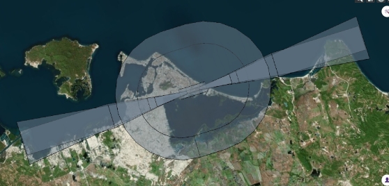
Non-precision RNP APCH obstacle clearance surfaces.
View module →
ILS CAT I/II/III & APV-Baro obstacle assessment surfaces.
View module →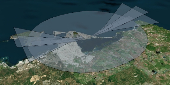
New ICAO OLS framework — mandatory by 2030.
View module →
Visual Segment & Obstacle Clearance surfaces.
View module →
Navaid Building Restrictive Areas per ICAO Euro Doc 015.
View module →Upload and evaluate any custom-defined protection surface.
View module →From setting up your first aerodrome to running a complete ICAO Annex 14 OLS analysis and downloading an official PDF report — this walkthrough covers the entire workflow.